Click to zoom photo
Wisconsin Great Outdoors
Get the flavor of Wisconsin’s Outdoors,
its Sanctuaries and Beauty
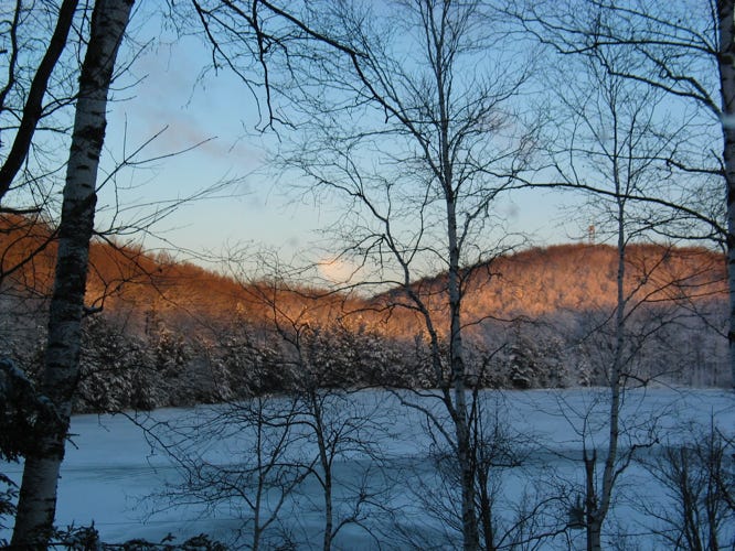
Wisconsin’s state and county parks systems are stunning natural environmental showcases. There are parks, forests, rivers, lakes, wildlife habitats and natural areas, and monuments. They all offer splendid scenic spots, picnic facilities, campsites, trails, and opportunities to learn. They are almost always accessible to everyone. You can explore at your pace and experience outdoor adventures of a lifetime.
“Climb the mountains and get their good tidings. Nature's peace will flow into you as sunshine flows into trees. The winds will blow their own freshness into you, and the storms their energy, while cares will drop off like autumn leaves. “
John Muir
“Let’s go to the park and have some fun.”
Arnold Schwarzenegger
Amnicom Falls State Park
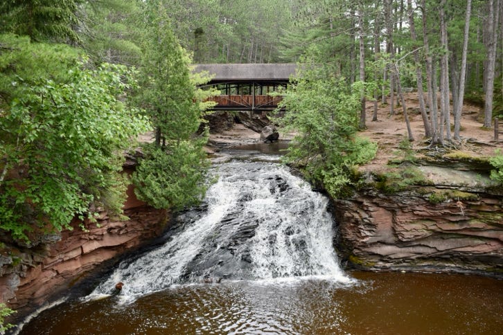
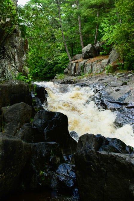
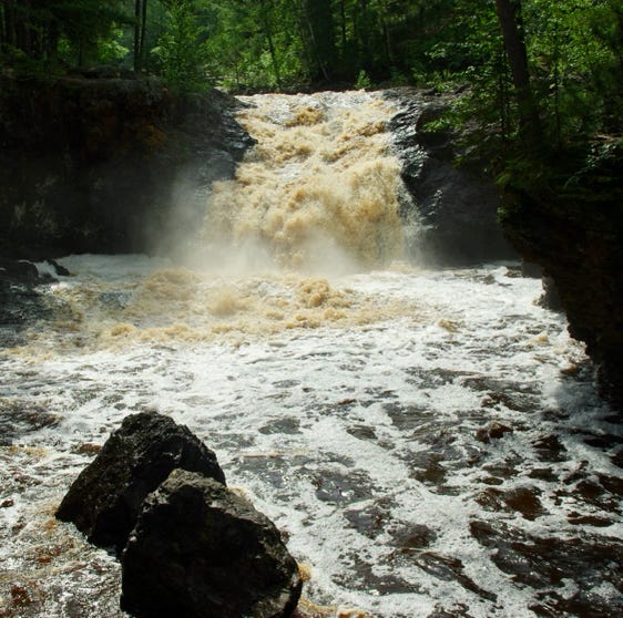
Amnicom Falls State Park is a great spot to visit. There are a series of waterfalls and rapids there, along with a covered bridge and several fun trails, places to picnic and camp. It’s quite relaxing to walk around and take it all in. The park is in the area of the Douglas Fault, which extends from east of Ashland to near Minneapolis-St. Paul. The great glaciers once occupied the area. This area was also rocked by many earthquakes back in the day. The two sides of the fault pushed up against each other.
The main falls Covered bridge over the Upper Falls Rapids below highway bridge
Brule River Bog
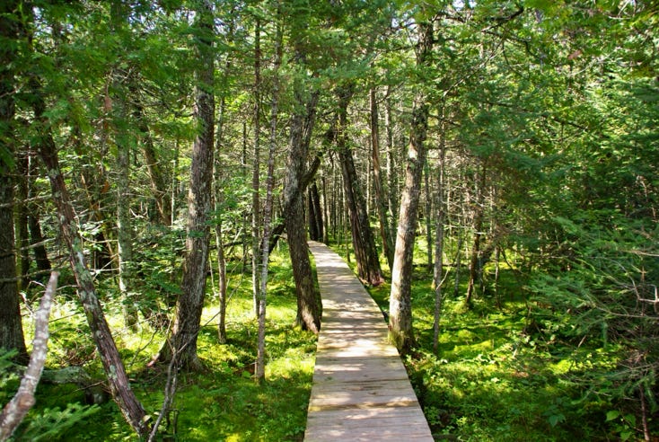
All 44 miles of the Bois Brule River are contained in the Brule River State Forest. The Wisconsin Explorer tells us, “The Brule Glacial Spillway is a continental divide. Both the headwaters for the Bois Brule and St Croix Rivers originate here … Hikers along the Brule Bog trail cross St. Croix Creek before entering the heart of the Brule Bog.” I walked along the boardwalk, which take you almost the entire distance of the bog. Iwas awed by the vegetation. It is a remarkable place to visit.
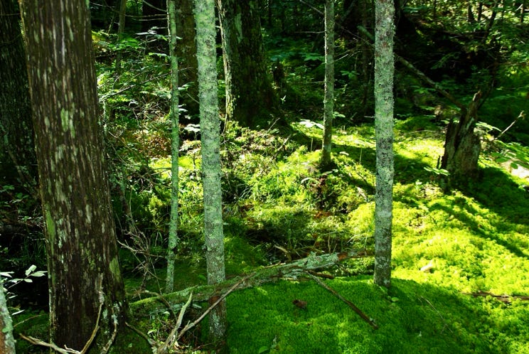
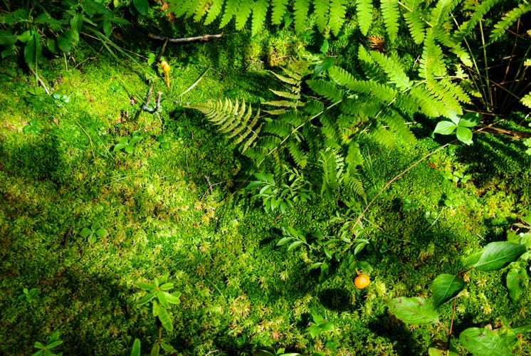
The Wisconsin Explorer goes on to say, “The Brule bog is dominated by white cedar trees, mosses, and ferns. The spongy layers of peat retain water and regulate the flows of the Bois Brule River … The Brule-St. Croix Portage is the route that was used by voyageurs to portage between the Bois Brule and St. Croix Rivers since 1680.”
Colfax Railroad Museum
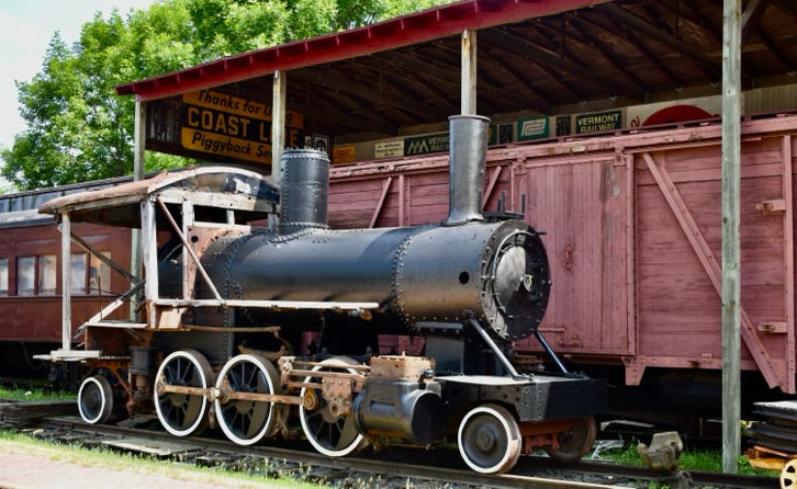
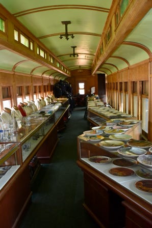
I must say I was astonished while visiting the Colfax Railroad Museum in Dunn County. This is your place if you are a railway buff. Outside, there is a variety of rolling stock, including locomotives, dining cars, freight cars, and my favorite, the caboose. Inside, there is a large assortment of historic railroad items. I might even say a gigantic assortment of historic railroad paraphernalia.
Loco-motion! Inside the dining car Historic railroad paraphernalia.
Dave’s Falls County Park
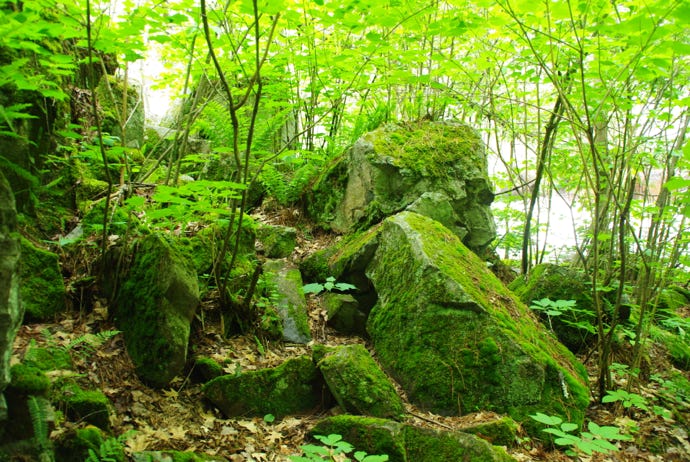
Dave’s Falls County Park is in Marinette County, one mile south of Amberg. One of the falls is a drop of about 10 ft., the other about 6 ft. So this is not Niagara Falls, but the falls are pretty, and you can get up close. There are no railings when you climb around on the rocks to get the perfect photo, so watch your step. Furthermore, the surrounding rock and lush vegetation are enchanting.
Volcanic rocks or result of tectonic shift? Upper Dave’s Falls Vegetation is lush and abundant
Dells of the Eau Claire
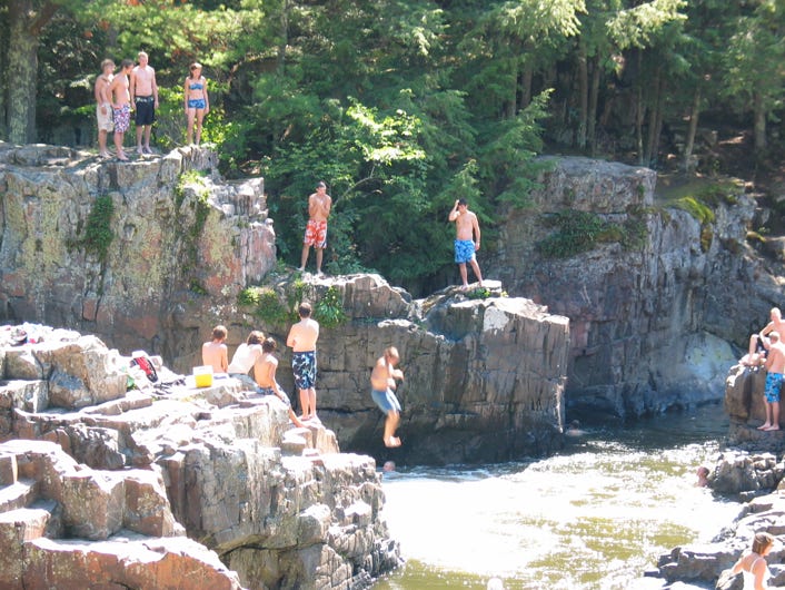
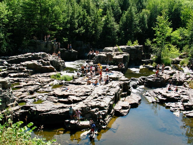
Dells of the Eau Claire is in Marathon County, near Wausau. A scenic, narrow rocky gorge and waterfalls are there. It is a delightful place. Many visit the Dells, and swim there, even dive there. I visited it many times when I lived in Wausau, and enjoyed each visit. The Eau Claire River rises in Langlade County and empties into the Wisconsin River just south of Wausau. The Dells was A second Eau Claire River is far to the west and is a tributary of the Chippewa River.
Jump and dive at the base of a falls Magnificent rock formations Sunbathing and swimming in the Dells
Dunnville Wildlife Area
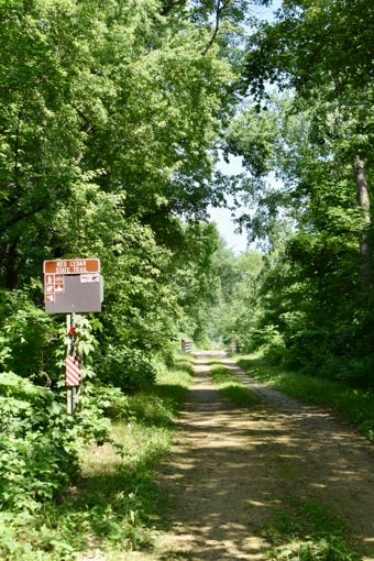
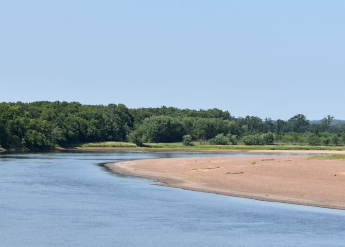
The Dunnville Wildlife Area is a bit tricky to find, but it is worth a try, whether you are interested in wildlife or not. It is often referred to as the “Dunnville Bottoms.” It is southeast of Downsville, which is a tad south of Menomonie. Take Hwy 25 south out of Menomonie of Downsville to CH Y, left on it. Cross The Red Cedar River and immediately look to your right, to a gravel road, Dunnville Rd. and the entry to the Wildlife area. Drive to the end and the parking lot. Then look for a path through the foliage that will take you to the Red Cedar River Trail. Turn left at onto the trail, walk, and approach the river and the Bottoms. You will be surprised to see a beach. Continue on the Red Cedar River Trail, and you’ll cross the river and tie into the Chippewa River Trail. I’ve been here several times and enjoyed it each time.
Look for this entry The “Bottoms” beach A walk across the river
High Cliff State Park
High Cliff State Park is on Lake Winnebago, Wisconsin’s largest lake. It presents a wonderful look at the limestone cliffs of the Niagara Escarpment, which parallels the eastern shore of Lake Winnebago. These cliffs are sacred to Native Americans. It has an observation tower for you to climb for a great view of the lake. It would be a terrific climb in autumn to view the colors.
Plenty of rock formations to see up close Observation tower I saw people walking through gaps in the rocks below
Highground Veterans Memorial Park
The Highground Veterans Memorial Park has grown to a 155-acre Park whose mission is to Honor, Educate, and Heal our Veterans, their families, and all who visit. The layout and tribute monuments are spectacular. Veterans of all The Tributes include WWI, WWII, Korea, Vietnam, the Persian Gulf War, and Afghanistan. They also include Tributes to women who flew as service pilots in WWII, nurses, Native Americans, and more.
Persian Gulf Tribute Vietnam Memorial - “Fragments” WWI Veterans
Horicon Marsh
Horicon Marsh is the site of both a national and a state wildlife refuge. It is the largest freshwater cattail marsh in the United States. I found it intriguing to drive and walk around the marsh. I enjoyed observing professional and amateur bird watchers at their work. They seemed to concentrate their efforts on the southern section of the marsh, which is run by the state. Their example soon caused me to look around to see what I could see. I tried to track Pelicans with my camera. It was fun.
The boardwalk into the marsh The only tree in the marsh A goose frozen by my presence
Interstate Park
The Interstate Park straddles the Dalles of the St. Croix River in both Wisconsin and Minnesota. As the Ice Age ended, huge glaciers melted, and the water carved the deep, steep-walled gorge known as the Dalles of the St. Croix River. The river cut through basalt by meltwater drainage from Glacial Lake Duluth. Erosion, frost, and gravity acting on the bedrock have resulted in vertical cliffs, unusual pinnacle forms, and rocky talus slopes. The site is well known for its cylindrical potholes, which were formed by the grinding action of sand and small stones swirling in strong currents. Some of the potholes are quite spectacular in size .
Dalles of St. Croix River Long, narrow, rocky channel Pothole formed by the currents
Kohler Andrae State Park - Dunes Cornwall
The Wisconsin Explorer has an excellent description of this park: “The Dune Cordwalk Trail is a 1.3-mile linear footpath through the Kohler Dunes State Natural Area at Kohler-Andrae State Park in Sheboygan. This unusual trail is surfaced with a string of cordwood planks pinned into sand dunes. The strange landscape of shifting ground makes walking this trail feel like exploring a distant planet.” I walked the trail. The cord walk, as I recall, is not difficult, but it is weird, especially when it goes up and down the dunes. You do get a bit of a workout — maybe more mental than physical. It’s hard to explain, but definitely worth the visit.
took these photos from the cord walk and did not venture down into the brush, but I suppose you can.
Ledge Park
Ledge Park lies along the Niagara Escarpment in Dodge County. Hiking trails wind along the ledge. You can hike and see rock formations amidst heavily wooded areas. The park also provides a fabulous view of the Horicon Marsh. The Ledge Park Trail is a 1.3 mile-out-and-back trail to view the marsh. I was at the park in April. The trees had not yet blossomed so I got some good views of the rock formations that might otherwise be hidden in summer.
Lion’s Den
The Lion’s Den Nature Preserve is one of the last stretches of undeveloped bluff land along the Lake Michigan shoreline, from Mequon up to Port Washington. I was taken aback when I walked through it. The bluffs are beautiful, as are the beaches on Lake Michigan below. From what I saw, this is a favorite place to park your RV and camp out. Many people use this park for nature walks, educational tours and photo shoots.
Happily surprised to see the bluffs Wide variety of physical surroundings Terrific paths and walkways
Lime Kiln Park
Grafton, in Ozaukee County, is home to Lime Kiln Park. I was astonished when a friend introduced me to this park. So, what is a kiln? It is a kiln, which is a thermally insulated chamber, used for the calcination of limestone (calcium carbonate) to produce the form of lime called quicklime (calcium oxide). In the early 20th century, Wisconsin was ranked third nationally in lime production. Lime was used to whitewash buildings, condition soil, treat animal hides and leather, and for plaster and mortar, and crushed limestone was used for roadbeds. The Milwaukee Falls Lime Co. operated a limestone quarry in Grafton. Cordwood was used as the fuel, and placed in the bottom of the kiln. Limestone was crushed, often by hand. When heated to over 1800 degrees F. The fire might burn for several days, carbon dioxide escapes leaving lime. Carts would be drawn to the top of the kilns by rail. The limestone would then be dumped into the kiln, and the heat would do its magic.
Madeline Island Big Bay State Park
Take the short ferry ride from Bayfield to Madeline Island and La Pointe, Wisconsin. I was there after the summer season, so La Pointe was not bustling. I decided to go to Big Bay State Park because it has a wonderful 3.5 mile out and back boardwalk crossing the Big Bay Lagoon.
The ferry ride was most enjoyable The boardwalk is well done Great views of the beach and lush vegetation
Oakfield Ledge
Oakfield Ledge exposes one of Wisconsin's best views of the Niagara Escarpment. The Niagara dolomite has resisted erosion but is characterized by deep crevices and long fractures. I found it hard to find the Oakfield Ledge on my first visit. Go to the town of Oakfield southwest of Fond du Lac on Hwy 151 and CH D. This will bring you into town. Take Main St. south to CH B, W. Waupun St. Stay alert for Breakneck Rd. and turn left to the east. Shortly after you pass Center Line Rd., the Oakfield Ledge State Natural Area will be on your left. Even then, the park is not well marked. There is a small gravel parking lot adjacent to a field. Walk on the worn path through the field and into the treeline. The Niagara Escarpment is there, waiting for you. I was thrilled to find it and explore it on foot. You must peer through the foliage.
The path to the Escarpment Peer through the foliage Incredible formations in there
Parfrey’s Glen State Natural Area
Parfrey’s Glen is Wisconsin’s first State Natural Area and among the most visited natural areas in the state. At its uppermost part, the glen reaches a depth of nearly 100 feet and embraces a mountain-type stream flowing through its floor. The Glen’s walls are sandstone embedded with pebbles and boulders of quartzite. The glen has been ravaged by floods over the past two decades which have destroyed bridges and the trail so beloved by travelers in the 80s and 90s. The area became too expensive for the state to maintain. Nonetheless, it is a wonderful place to visit. Visitors can still hike the stream to the pool below the waterfall, but must stop there.
The beauty of the glen is mesmerizing. Trail’s end, and I did not go further, but you can The stream winds its way through
Pattison State Park
Pattison State Park, like Amnicom State Park, is on the Douglas Fault. Compressional forces within the earth’s crust created this fault. It is an exciting place to visit, because of the Manitiou Falls, which was created by the fault. Manitou Falls is the highest fall in the state, and the fourth-largest waterfall east of the Rocky Mountains. I was pleasantly surprised by how close I could get to the top of the falls. There is a well built lookout at the top. Additionally, you can get a great view of the falls from its other side .
Manitou Falls and the lookout She drops 165 ft. A look from the top, over she goes
Peshtigo Fire Museum
I am not one to rush off to a museum. I bumped into the Peshtigo Fire Museum on my way to Marinette. I knew nothing of the history of this community so I went in. I was surprised to receive a warm welcome from two volunteers standing at the door. The Peshtigo Historical Society runs it. On October 8, 1871, a firestorm thundered through the town and surrounding areas and killed 1,500-2,000 people. It also destroyed the entire community. I could hardly imagine such a tragedy. On walking in, you can see a wide set of murals depicting the town before the fire, during the fire, and after. These murals alone make the visit worthwhile. The museum hosts a variety of artifacts through which you can browse at a leisurely pace.
Back in the day Mural depicting the rage of the fire Thompson boat built in 1914
Point Beach State Forest
Point Beach State Forest features 3,000 acres of land and 6 miles of sandy beach along the shores of Lake Michigan. Point Beach offers family campsites, two large group cabins, an outdoor group camp, and a 13-mile out-and-back trail near Two Rivers. A popular feature within the property is the Rawley Point Lighthouse, which has been operated and maintained by the U.S. Coast Guard since 1853. The state forest nicely mixes forest, lake and beach.
Sand dunes at edge of forest and beach The beach Rawley Point Light House
Prairie Dells Scenic Area
When I first visited Prairie Dells Scenic Area, I felt like a French explorer who came upon a once-in-a-lifetime fabulous place. I still think that. You’ve got to pay attention to find it. Get to Merrill in Lincoln County. Take Hwy 64 east out of the city and turn left on Hwy 17 N. Start paying attention once you pass CH C. Watch for Prairie Dells Rd on the left. Take it until it ends in a parking lot. Follow the worn path to where the land opens up, hag a right, and walk to the Prairie River., I have sat there on the rocks for many an hour, breathing in the freedom and beauty of the area. There is a wonderful river gorge and rock outcroppings. If you explore the area a little, you will find a way down to the river. Just remember you’ve got to come back up!
I usually sit over here To enjoy the Dells below I went down to the river here
Raspberry Bay
Raspberry Bay is at the northern tip of Door County, north of Red Cliff, which is north of Bayfield. I took Blueberry Rd north out of Red Cliff. After a while, it will turn to the west. Watch for Campground Lane on your right and turn on it heading north. I parked on it and found a path to the water and the beach. The beach does have a raspberry tint to it. I was there in August, and no one else was there. It is a beautiful location and fun driving this circuitous route.
It is on the Red Cliff Band of Lake Superior Chippewa Reservation. Therefore, as it is with any land in the state, it is prudent to treat it with great care.
That’s my puppy Cricket on the beach Marvelous rock formation I walked to the end, spectacular!
Rib Mountain State Park
Rib Mountain State Park, just outside Wausau is a premier place to visit. Rib Mountain is the third highest point in Wisconsin at 1,942 ft.above sea level. It is 741 ft. above surrounding terrain so it is easy to spot. There is plenty to do at this park, including trails, the observation tower, or just sitting in the amphitheater to gaze out at the scenery below. In winter, this area, known as the Granite Peak Ski Area, is a haven for skiers and snowboarders with near 60 runs.
Rib Mountain from 10 or so miles away Metamorphic rock called quartzite Four-mile long ridge of ancient rock
Rogers Street Fishing Village
It’s fun to visit the Rogers Street Fishing Village, a maritime museum and heritage park, in Two Rivers. It is known as the “French Side Fishing Village Historic District.” French from the motherland and French Canadians from Quebec established themselves here. It is on the list of the National Register of Historic Places. The 1886 Lighthouse was the first one in the city. It is made entirely of wood. It is known as a Pierhead Light. That means its primary duty was to mark the harbor entrance. It once stood on the north pier of the harbor. The city moved it onto the museum grounds in 1975. There is some great history behind this lighthouse.
The Village from across the river Pierhead Light LeClair Fish Shed
Ship Rock
Ship Rock Wayside is off Highway 21 near Coloma. It is a butte or mesa, a sandstone formation, the remnant of an island in glacial Wisconsin. You can walk around the entire circumference of the rock to view it up close. You will probably see rock climbers going up. I saw two guys up on the side, and one crawled into a crevice in the formation. I did not think this was a good idea. Unfortunately, some people have put graffiti on the rock, but it is still fun to view.
Ship Rock from the wayside Backend trail A different view
St. Feriole Island Park
St. Feriole Island lies adjacent to the City of Prairie du Chien. There is a lot to see and do at St. Feriole Island Park. It hosted Ft. Crawford during the War of 1812. The historic Villa Louis Mansion is also here, built by people who made their riches in fur trading and land dealings. The old four-story Dousman Hotel is here, having thrived during the railroad boom. The Depot Bar on the Mississippi River serves beverages and food. The depot for the Chicago, Milwaukee & St. Paul Railroad is on the island as well. Go deep into the island's northern part, and you will see a host of old rail cars. As you can see, I was here during an overcast day.
Villa Louis Mansion Old army blockhouse Dousman Hotel
Timm’s Hill County Park
Timm’s Hill is the highest point in Wisconsin at 1,951 ft. above sea level. When you go to visit, you might say, this doesn’t look so high to me. That is because you are in the Northern Highland Geographic Province of the state, which ranges in height from 980 ft to 1,600 to as high as 1,951 ft. Much of the region surrounding Timm’s Hill is already quite high for the state, with multiple sections at 1,800 ft. When you visit Tim’s Hill, be sure to stop at Bass Lake and the Highpoint Village resort and walk around the lake enclosed by wonderful forests. I also recommend you climb the tower and look over the Northern Highland.
Timm’s Hill above Bass Lake A spectacle in fall A sensation in winter
Wausau Whitewater Park
The Wausau Whitewater Park is said to be the best in the Midwest, maybe in the nation. Whatever the case, if you like to run the rapids, you know about this park, or should. If you might like to watch people trying their hand at the rapids, I commend the park to you. I have done this several times and have some great photos of those in the run fighting it out. The course lies in a side channel of the Wisconsin River below the dam in downtown Wausau. It is in the downtown area, making it even more special. Numerous local, regional, and national events are held here.
He came down and fights to go back up This guy is just fighting to stay upright Two in the canoe coming down the run
Wequiock Falls
Wequiock Falls Park is off Hwy 57N on the northeast side of Green Bay in Brown County. It is a small park, but I thoroughly enjoyed myself there. It contains a large ravine that enables you to get a close-up view of the Niagara Escarpment rock formation. In spring, the flow from Wequiock Creek forms a delightful waterfall. There is a wooden walkway down to the falls. If you are nimble-footed, you can walk on the rocks, some of which have a bit of water on them, so wear rubber shoes. By doing this you can get quite close to the falls. Above the falls, there is a very agreeable picnic area. The entire park is worth a stop to see the falls and have lunch.
Follow the path to the stairs Wequiock Falls Walk out there if you wish
Wisconsin State Fire & EMS Memorial Park
The Wisconsin State Fire & EMS Memorial Park is in Wisconsin Rapids. To my mind, it is a unique and lasting way to recognize and extend your gratitude to those who serve to fight fires and provide emergency medical services to those in need. It is in a beautiful setting in the Wisconsin River. Many hundreds of firefighters in the state have given their lives in the line of duty. They are memorialized here. The site’s design is emotional, yet gratifying.
The signature monument A place to rest and remember Final alarm bell tower
Whistling Straits
I am not a golfer, and you might not be either. Nonetheless, a visit to Whistling Straits on Lake Michigan north of Milwaukee is worth the visit. It’s on-line website page says, “ Sculpted into the Wisconsin coastline, the Straits and Irish are throwbacks to the raw freshness of Ireland, offering two courses of dynamic contrast and world-class prestige.” This is quite accurate. My photography cannot duplicate what you’ll see. The contours of the windswept course on the shore are gorgeous, numbing in their beauty, and golfing degree of difficulty. I cannot imagine anyone playing this course. But they do. Once again, from the website, “Home to major championships and the 43rd Ryder Cup, the Straits is defined by the open, rugged and windswept terrain, sculpted along two miles of Lake Michigan shoreline.” It is worth a visit.
The Clubhouse The contour of the course Its place on Lake Michigan’s shore
Wyalusing State Park
Wyalusing State Park is a first-class place to visit to get a view of where the Wisconsin River meets the Mississippi. But getting that view can be tough. Start with a nice day and good visibility. The park is just south of Prairie du Chien on the south side of the Wisconsin River, in Grant County.I did not go on the trails. My guess is you get the best view of the confluence of these two great rivers from them. I did my best in my car. Next time I might try a drone!
You can see the confluence, sort of … Wisconsin River foreground, Big Guy way back there The Wisconsin River winding its way