Click to zoom photo

Highlights I wanted to share, 

    the next stories, those I want to tell

Chris Claremont, a Brit by birth, is an American comic book writer and novelist, who worked for Marvel Comics. He once wrote, “The more stories I told, the more I found I wanted to tell. There was always something left unsaid. I got hooked by my own impulse of 'Well, what's gonna happen next?’”


That’s the way I feel about highlighting stuff about Wisconsin for you that cannot be left unsaid.


Claremont expresses my feeling perfectly: “What excites me, what attracts me, what gets me up in the morning is telling the next story and getting it out in front of readers and hoping they'll love it too.”


 There is no end to the stories I could tell. I hope you enjoy these.
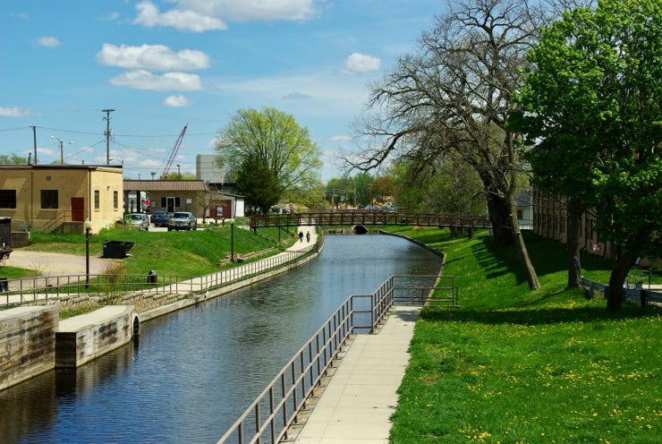
Portage Canal - Much ado about something

While living in Wausau, traveling south on I-39 and then on I-90, I passed signs for Portage many times. Honestly, I never thought much about it. Then one day, I decided to stop and see the town. I then learned the city is named Portage for a reason: a canal connects the Wisconsin River to the Fox River. You might ask, “So what?”


Get out your atlas. The net effect is one could travel by water from the North Atlantic Ocean, through the St. Lawrence Seaway into the Great Lakes to Green Bay and up the Fox River through the Portage Canal to the Wisconsin River to the Mississippi River and into the Gulf of Mexico! 


Specifically, how do you do that, you ask? 


The Portage Canal website provides some excellent background,


“The ‘portage’ between the Wisconsin and the Fox Rivers was used by Indians, early and unknown French explorers and fur trappers … The land lying between the Fox River and the Wisconsin River was known as in the early days as a ‘portage.’ A portage is the act of transporting boats and supplies from one waterway to another. It is unique as it is part of a natural water-shed or is called a ‘continental divide.’


“The Indians called the ‘portage’ Wau-wau-o-nah, now more commonly known as ‘Wauona’ which means ‘the place where one takes up his canoe and carries it on his back.’ The one and four-tenths mile trail through this marshy area was very difficult. Sometimes during high water boats could paddle from one river to the other.” 


Multiple efforts were made to construct a canal joining the Fox and Wisconsin Rivers. The first three failed. The final one, conducted by the Army Corps of Engineers, succeeded in 1876. The Portage Canal website says,


“In 1874, the Corps of Engineers, Department of Army started at the Fox River end and completed the canal in 1876, which was 75ft. wide, 7 ft. deep, 2 1/2 miles long with a draw of 6 ft., a right of way on the Northside of 45 ft. and 75 ft. on the Southside. The first boat through the completed canal was the Boscobel, on June 30, 1876. According to the Fort Winnebago Lock Tenders book dated 1878-1908, there were many big boats through the canal, some of 300 ton capacity, as well as pleasure craft. The canal was used until 1951 when the Fort Winnebago Lock was bulldozed in and the Wisconsin River Locks welded shut. In 1961, the ownership of the canal was transferred from the Department of Army to the State Of Wisconsin.”


The Wisconsin Department of Natural resources is the governing authority but has done little to maintain it, though it has worked to decontaminate it.


I said at the outset I visited the city of Portage. I explored the canal.

Columbia County published a “Portage Canal Background and Project Summary” in June 2013. This summary tells us,


“In 2001 the City of Portage received federal Transportation & Community & Systems Preservation program funding to rehabilitate the historic Portage Canal and to establish an adjacent pedestrian/bicycle trail.”


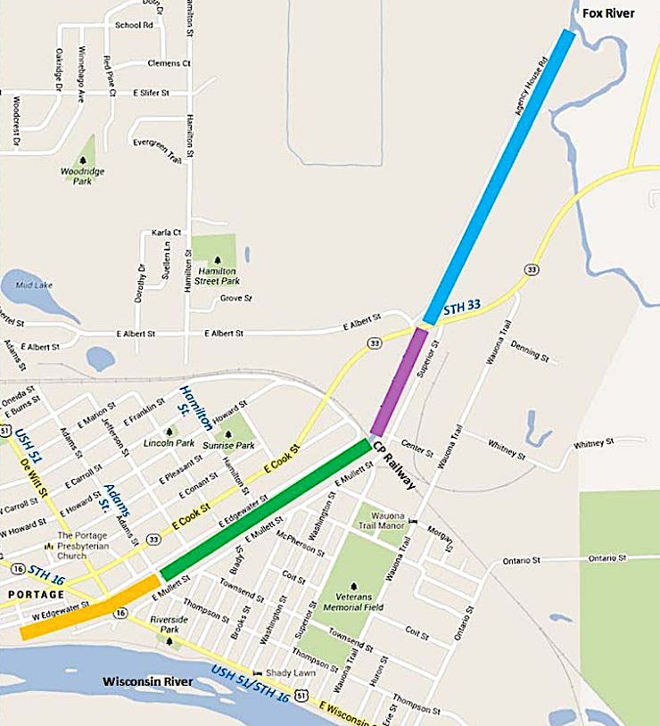
A design project began in 2002. It identified four segments to the 2.5 miles of the canal, shown by different colors on the above map. I present this map to show the geography of the canal. I will walk you through what I saw and photographed on my visit, starting with the Wisconsin River segment.


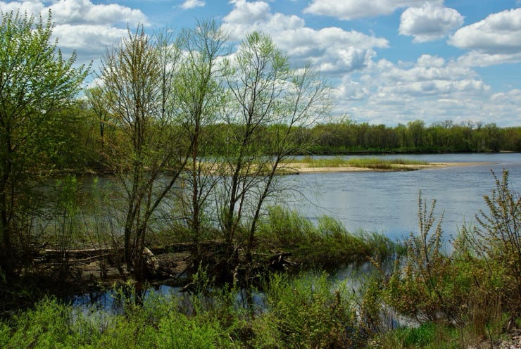
Out yonder in this photo, along the distant tree line, is the Wisconsin River. Toward the bottom of the photo, you can see a stream of water from the Wisconsin River. 


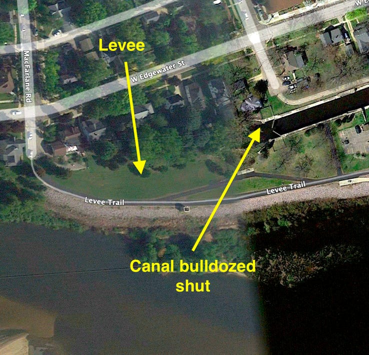
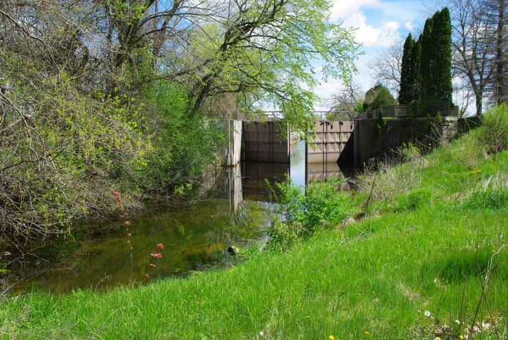
In 1951, the canal was bulldozed shut on the Wisconsin River end of the canal. Note the two gates near where the canal was bulldozed.


This photo shows those two gates. In the foreground, you see the water at the bulldozed Wisconsin River end ion the canal. You can also see the canal beyond the two gates.


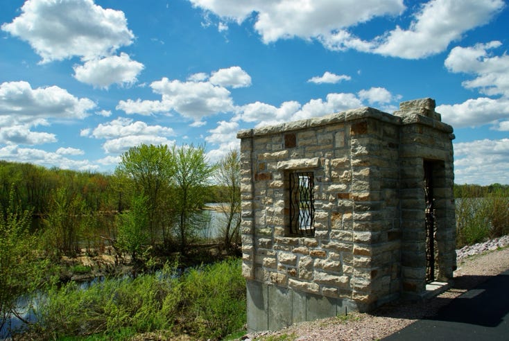
 I believe this old stone building was part of the lock at the Wisconsin end of the canal.


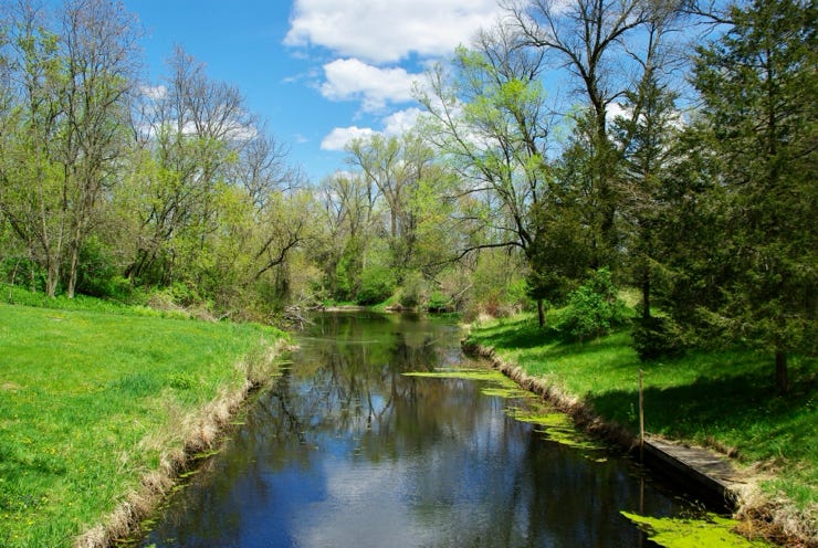
The canal travels through the city of Portage toward the Fox River. I’ll show you photos I took as I tried to stay close to the canal by car. 


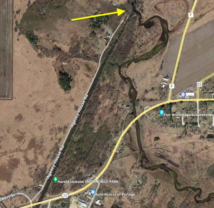
 I drove along the Agency House Road, which goes alongside the canal. Note the Harold LeJeune Snowmobile Park, lower left. It’s a pretty little park. I’ll show it in a moment. The arrow at the top points to where the road ends, and the canal meets up with the Fox River.


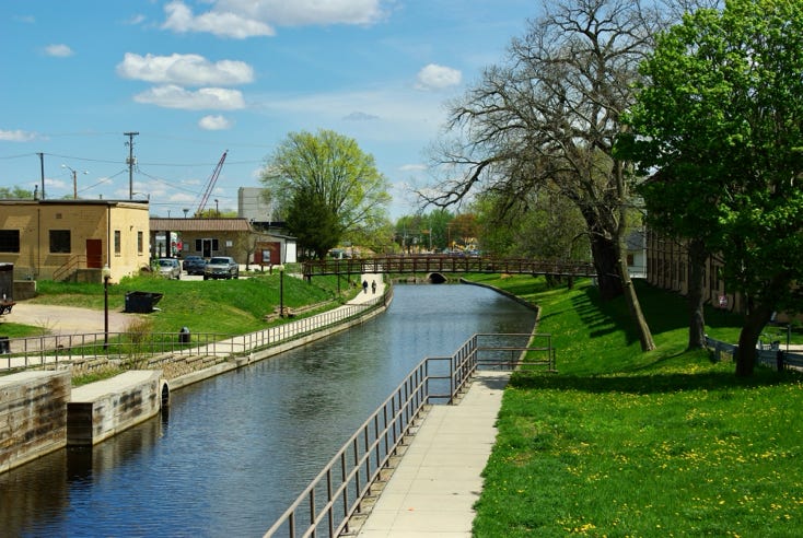
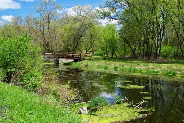
You can see the canal has widened a bit. The walking bridge you see crossing the canal meets the Harold LeJeune Snowmobile park on the other side. There’s the park. It’s dedicated to the Snowmobile Volunteers of Columbia County. It is an association established in 1972 to develop and maintain a system of public snowmobile trails. 


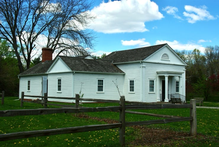
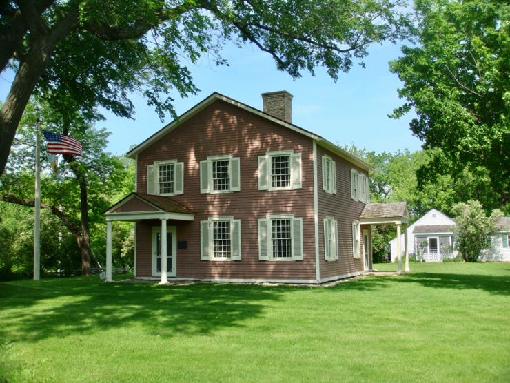
Next, I drove to the end of Agency House Road. I found there was a lot to do and see here.  In my haste,  I missed photographing the Historic Indian Agency House at Fort Winnebago. This is a photo of it taken by William J. Roman in 2011. Please note the white building to its rear. It is the Indian Agency House Museum. 


My mind was focused entirely on seeing where the canal met the Fox River and getting a good photo of that.


The Historic Indian Agency House at Fort Winnebago website will tell you a lot about this portion of the canal. It says,


“The Indian Agency House was built with federal funds in 1832 to serve as the home and workplace of Indian sub-agent John H. Kinzie. The late Federal-style home—designed to be an impressive symbol of the government’s wealth and power—was constructed on Ho-Chunk land just across the Fox River from Fort Winnebago. Many of the original features of this home, which continues to rest on a stone foundation in its original location, have been preserved.


“The agency house is a spacious timber-frame structure. Pine lumber was floated down the Wisconsin River from the forests of the north, and the house was furnished according to Juliette Kinzie’s refined tastes, featuring artwork, carpeting, fine furniture such as a sideboard, and a Nunns and Clark piano. While carpenters and masons were summoned from distant St. Louis, the stone was quarried nearby, and the bricks were made locally.


“From this home, Kinzie acted as an ambassador to the Ho-Chunk Nation. He distributed the annuity payments, received Native delegations, and settled disputes between Natives and settlers. At various times, the home was also used as a place for Juliette to educate local children, host social activities for those living in Fort Winnebago, and provide a resting spot for visiting officials. The home's use in these capacities was short-lived, however. Kinzie’s resignation and the relocation of the tribe across the Mississippi River soon rendered it obsolete.”


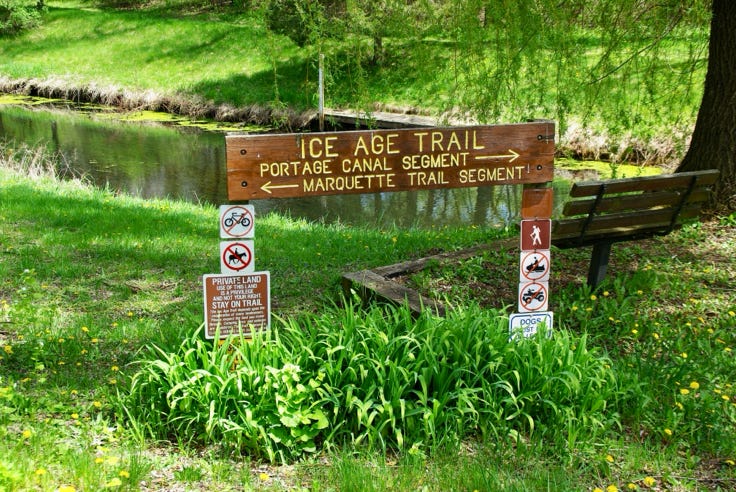
 I noted the Portage Canal Segment and the Marquette Trail Segment intersect here. The Portage Canal Segment originates in downtown Portage and runs up to this location, after which it takes over, following the Fox River.


This photo is interesting. I need to examine this spot more closely next visit. In retrospect, I should have crossed the bridge. You’ll note there seems to be a rock jam here. It turns out there is a gate under the bridge.


Here is a closer look. You can see the top of the gates, which are partially open. I do not understand why there is a buildup of rock-cement blocks there. I need a closer look. It looks like the canal to the right is at a lower elevation than the canal to the left.


Believe it or not, that’s the Fox River in the distance, center photo, perpendicular to the canal in the foreground, going from left to right in the photo. It was not apparent to me how to get over there. I might have been too tied to using my car. A more aggressive person would have figured it out.


Let me blow this photo up to show the Fox River more clearly. 


And that’s the name of that tune, the Portage Canal, start to finish!


St. Lawrence Seaway from the Atlantic Ocean through Lake Ontario. Take the Welland Canal passing by Niagara Falls and the Niagara River, to Lake Erie. Then take Lake Erie through Lake Huron passing by Mackinaw City into Lake Michigan to Green Bay. Take the Fox River through Lake Winnebago, Lake Butte des Morts, through Berlin, Princeton, Puckaway Lake, Montello to meet the Portage Canal to the Wisconsin River, to the Mississippi River and into the Gulf of Mexico. That would be one heckuva trip by boat.

This website makes use of cookies. Please see our privacy policy for details.

Deny

OK